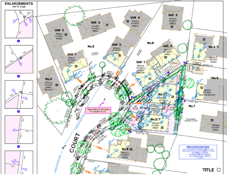
Site Development Survey
Site development survey, also known as site surveying or site analysis, is a process that involves the assessment and analysis of a specific piece of land or site to determine its suitability for development and to provide essential information for the design and construction of projects. This survey is typically conducted by land surveyors, civil engineers, architects, and other professionals involved in land development projects. Here are the key aspects of site development survey:
- 1. Site Assessment: The survey begins with a thorough assessment of the site's physical characteristics, including topography, soil conditions, vegetation, drainage patterns, environmental features, and existing infrastructure. This information helps in understanding the site's constraints and opportunities for development.
- 2. Boundary Identification: TSurveyors identify and mark the boundaries of the site accurately. This involves locating property lines, corners, and any encroachments or discrepancies. Boundary surveys ensure that the proposed development stays within the legal limits of the property.
- 3. Topographic Mapping: Topographic surveys are conducted to map the terrain and elevation of the site in detail. Surveyors measure and record contours, elevation changes, natural features (such as hills, valleys, and water bodies), and man-made features (such as roads, buildings, and utilities). Topographic maps provide essential information for grading, drainage, and site design.
- 4. Utility Mapping: Utility surveys are conducted to locate and map underground utilities, such as water lines, sewer lines, gas lines, electrical cables, and telecommunications infrastructure. Accurate mapping of utilities helps in avoiding conflicts during excavation and construction activities.
- 5. Environmental Assessment: Site development surveys may include environmental assessments to identify any potential environmental issues or hazards on the site, such as wetlands, endangered species habitats, contamination, or archaeological artifacts. This information is critical for compliance with environmental regulations and for minimizing environmental impacts during development.
- 6. Regulatory Compliance: Surveyors ensure that the proposed development complies with local zoning regulations, land use ordinances, building codes, and other regulatory requirements. They assess setbacks, height restrictions, parking requirements, and other land-use regulations to ensure compliance with applicable laws and regulations.
- 7. Site Design Support: Survey data is used by engineers, architects, and designers to develop site plans, grading plans, drainage plans, and other design documents for the proposed development. The survey provides critical information for optimizing the layout, orientation, and design of buildings, roads, parking lots, utilities, and landscaping features.
- 8. Construction Stakeout: Surveyors provide construction stakeout services to mark the precise locations and elevations of proposed structures, utilities, roads, and other site features on the ground. Stakeout ensures that construction activities are carried out according to the design plans and specifications.
Overall, site development survey plays a crucial role in the planning, design, and construction of land development projects by providing accurate and comprehensive information about the site's characteristics, constraints, and opportunities. It helps in ensuring the successful and sustainable development of the site while complying with regulatory requirements and minimizing environmental impacts.

